This is a ubiquitous problem. Perhaps you’ve heard the phrase, “stuck in the doldrums“? It’s a literal place where there isn’t much wind, and thus the bane of old-timey sailors. But the metaphorical doldrums are just as real. You can avoid the literal doldrums. You can at best only try to avoid the metaphorical ones. Whether it’s literal or metaphor though, the way out is the same: Concerted, intentional effort to go somewhere else.
As I headed out of Asheville, North Carolina it occurred to me to wonder why I was heading north on Interstate 26. It was clearly labeled “North,” I was currently pointed north, and as far as I could tell—glancing at the dashboard’s big bright display while negotiating the swerving and undulating roadway—it was going to take me very-much northward. None the less, even-numbered Interstates are usually east-west routes. Also odd: The signage in North Carolina said “future” I-26, but it looked pretty in-existence to me.
North Carolina’s license plates say, “from sea to mountains.” Or something like that. Asheville and surrounds take that seriously. Lots and lots of hills and mountains and valleys for my little 4-cyclinder van to lumber up and down. Dang pretty though. Lots of evergreens, but enough deciduous trees that I bet the fall foliage is a spectacle.
At which point Siri announced: “Welcome to Tennessee!” Wait, wat?
I really should look over the map route before I start driving. I was expecting to go straight from North Carolina into Virginia. In hindsight, I see that was an option if I’d gone east from Asheville and northward from, like, Charlotte. And so I got an extremely brief glimpse of an extremely beautiful part of Tennessee.
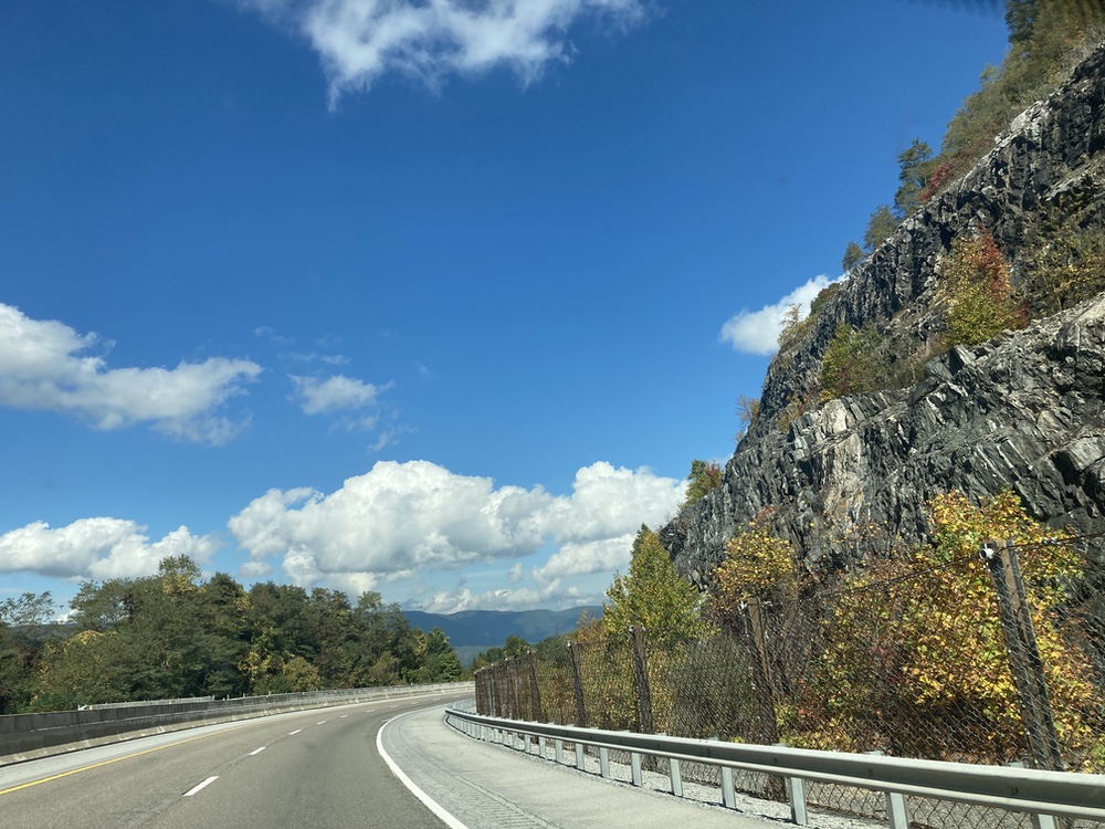
But first, I drove up and down 42 steep hills like this one:
Somewhere along the way I saw a sign for the almost-was-a-State of Franklin. I’d read about that years ago, and—serendipity!—here I was driving through it. (The entire far-eastern pointy bit of Tennessee was once almost-sort-of Franklin.) Anyway.
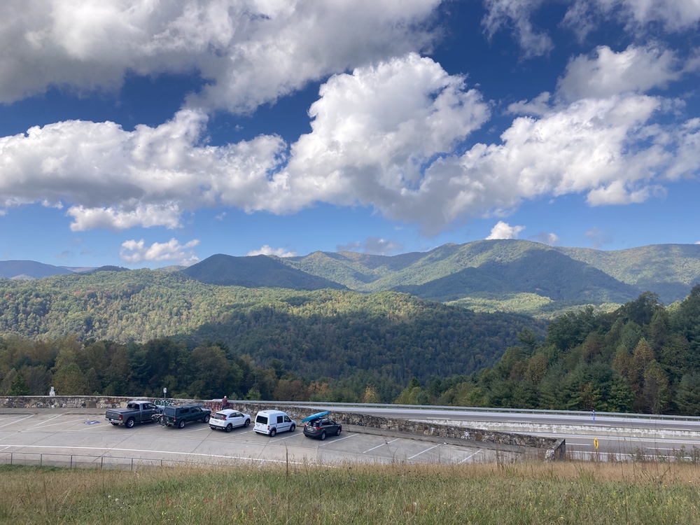
Eventually I reached that quintessential American experience: The scenic overlook. I parked here:
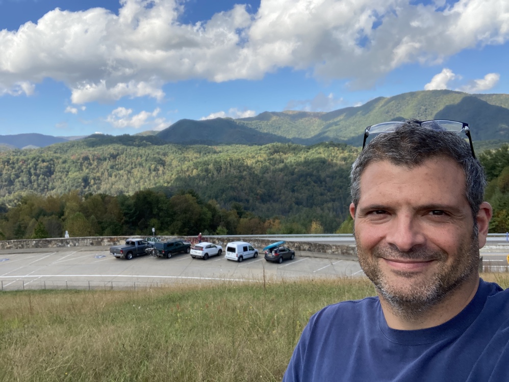
I can tell when I’ve been sitting too long, riding in a car for days… I get the urge to bound up the stairs, one might even say the urge to run. Same shot, selfie-mode:
Two tricks to better selfies: Look at the camera lense, not the screen, as you trip the shutter, and intentionally lower the shoulder of the arm holding the camera. The one shoulder scrunched up is the dead-giveaway in selfies. Also, dude, get a hair cut and shave.
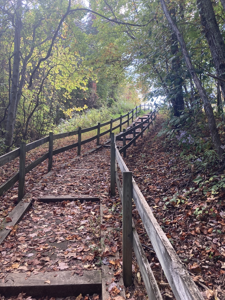
As I was strolling away, I realized there was a side trail. It mentioned 800 feet, and 150 feet vertical. I didn’t “run” up. I briskly walked up while thinking, “oooooh max heart-rate cardio… didn’t see that coming either.” But it was worth it:
In 1784, before Tennessee’s slender shape had ever been imagined and drawn on a map, there were rumblings of discontent in three counties in western North Carolina : Washington, Sullivan, and Greene. These small counties were isolated from the rest of North Carolina and their governing representatives, separated by the formidable Southern Appalachian mountain range. Residents were all too aware of how the mountains they lived in and around disenfranchised their lives.
Today, from the wait-wat?! department: There was almost-sort-of a fourteenth original state—except the Continental Congress never recognized it. Oh, geo-politics are complicated. *wry smile*
More seriously, Atlas Obscura is a terrific web site ticking off an endless list of amazing, surprising or simply interesting places on this magnificent marble we call home.
Ironic, as it is actually Mackenzie who holds the distinction of leading the first recorded crossing of North America, not Lewis and Clark. In 1793, Mackenzie made a second attempt to cross the continent, over an extremely rugged section of modern-day British Columbia. He reached the Pacific north of Vancouver, and in so doing, beat Lewis and Clark by a dozen years. Mackenzie’s published memoir of the trip inspired Thomas Jefferson to send Lewis and Clark at all, and they carried a copy of the best-selling book in their canoe.
If you are not following Atlas Obscura you are seriously missing out. I had an idea much like it, about 20 years ago and I never followed through. Meanwhile they have done it WAY better than I think I could have. Every day they post a couple of obscure things about our world.
This particular item is SOOOOO MUCH FUN! I thought (ie, I was told, in primary school and high school) that Lewis & Clark were these great adventurers who set out across the …. NOT. They took a copy of this other guy’s book with them.
Meanwhile, Internet for the win! As you read the story — seriously. go! — it talks about a “bend in the river” where they misjudged how much it was redirecting them. (Complicated by no maps, bad magnetic north issues in that area, etc) And TODAY you can go to this Google map link and you can see it’s like… “Yay! We’re going west on this river and we’re going to reach the Pacific ocean by going below Alaska…” *sad trombone* and the river makes this VICIOUS hard-right turn and “booooo! We’re going to the Beaufort Sea in the Arctic Ocean….”