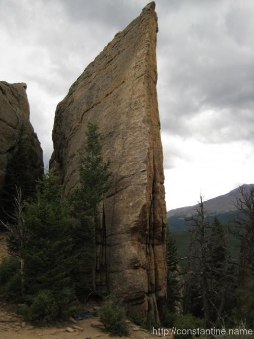
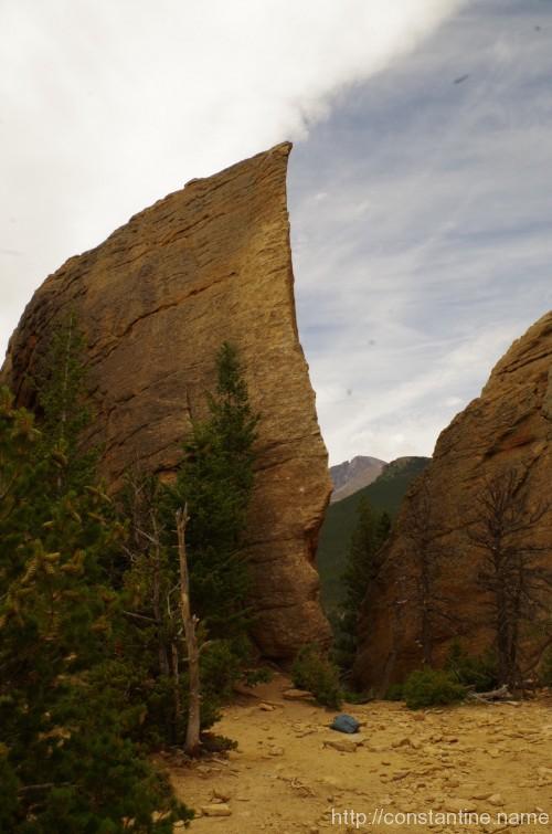
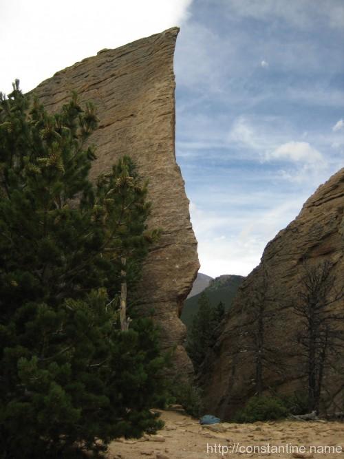
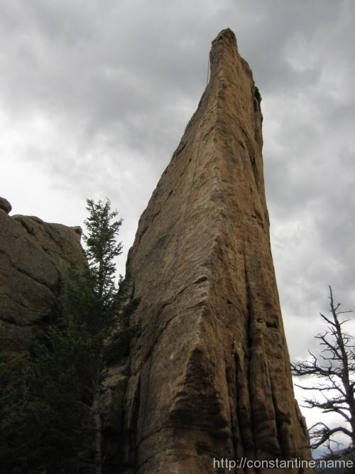
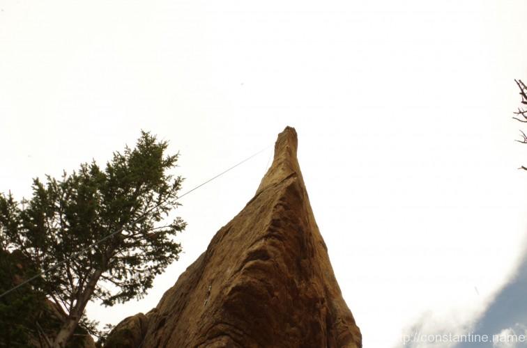
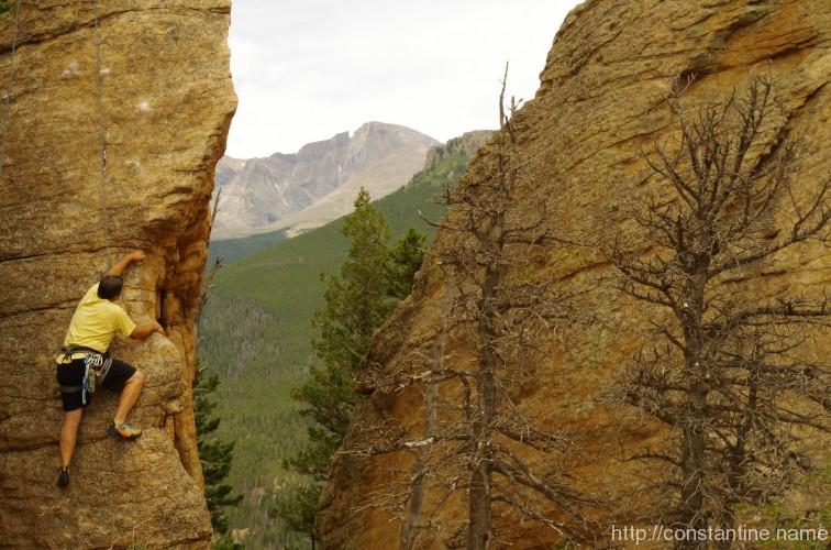
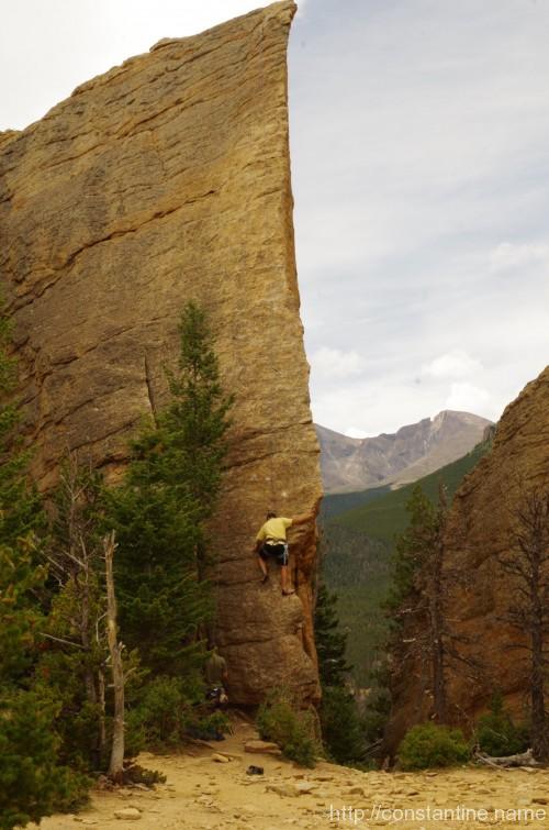
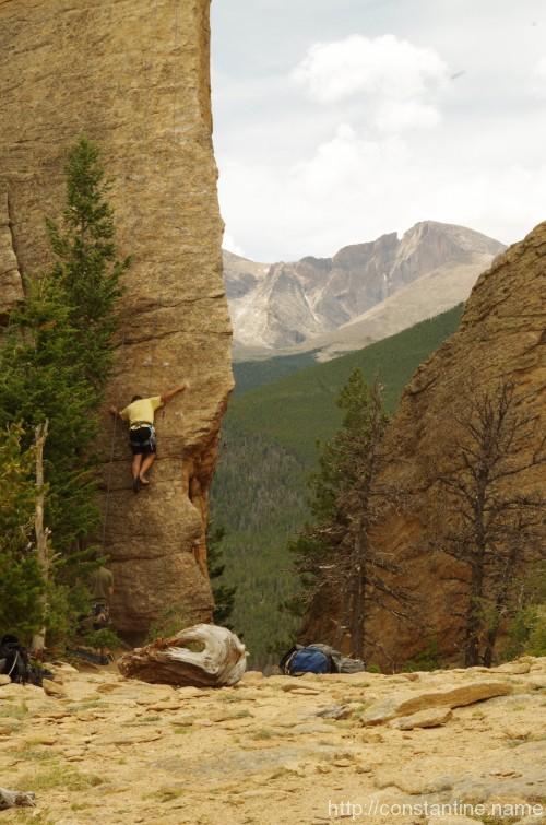
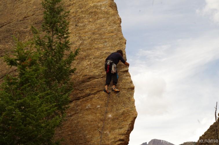
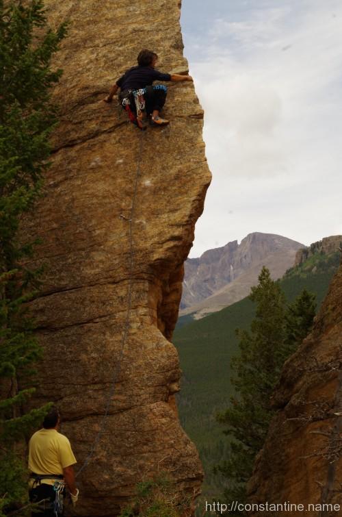
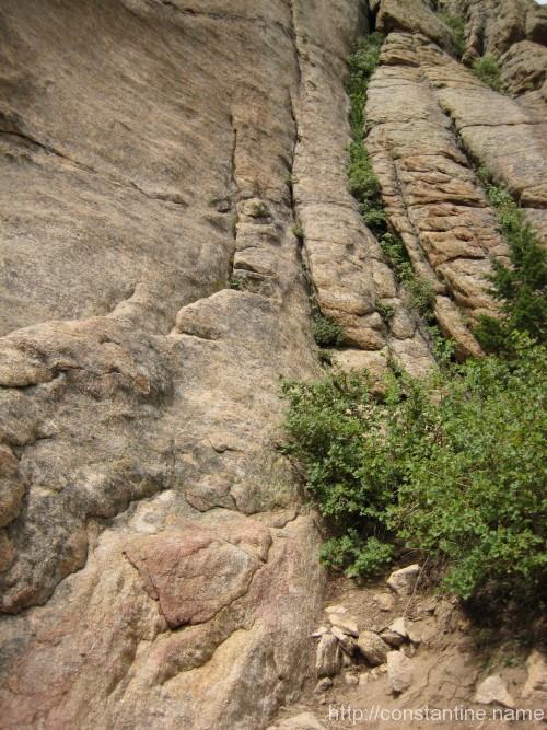
In Jurassic Park there’s a route called The Edge of Time (5.9R ***) which is on the cover of the guide book.
Simply an unbelievable piece of rock carved into a literal prow.
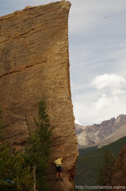
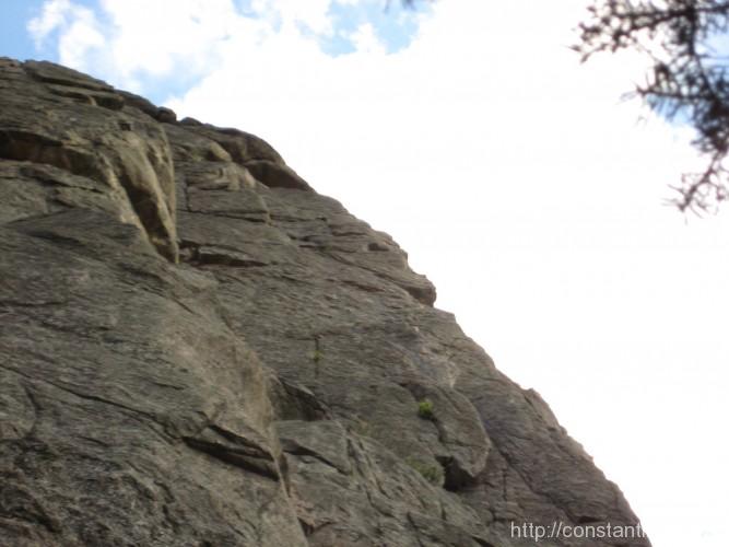
My attmept was sketchy. I spent a while projecting the 5.9 crux (which is way above my climbing grade.) Eventually, I punted and move left to East of Eden (5.9 *) and worked my way up, and then back over to finish the arete. (Sadly, no photos of me un the upper part of the Edge.)
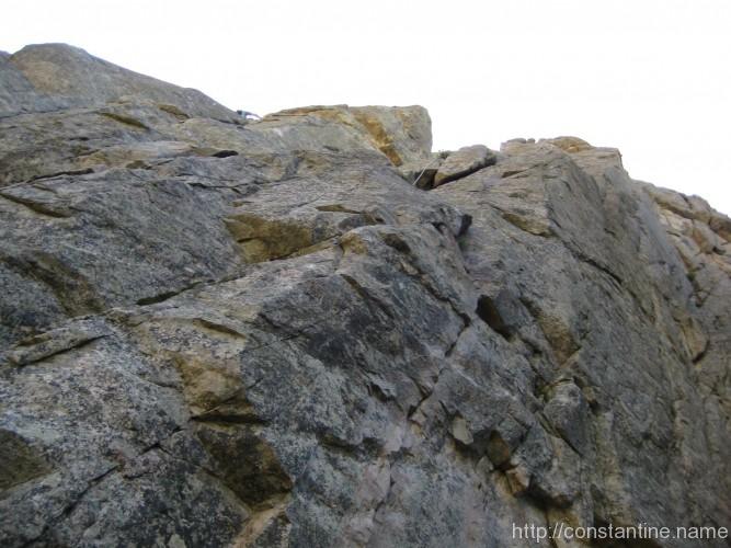
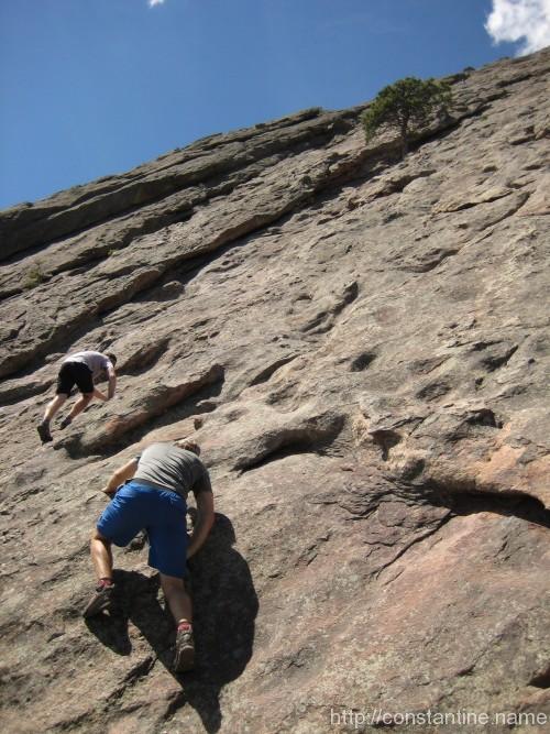
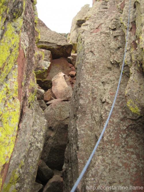
Along the Edge of Time
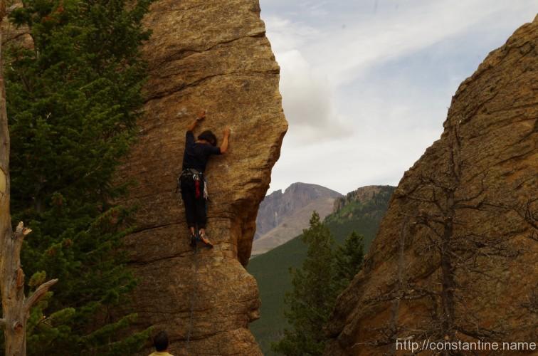
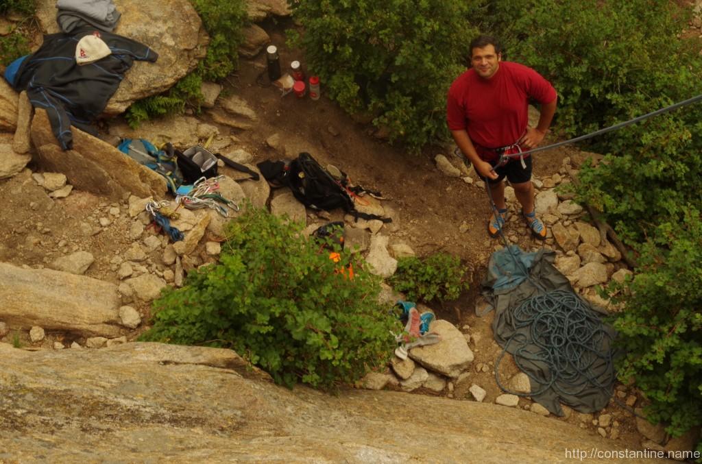
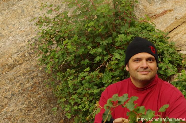
Mike’s run up was a straight shot as he put up the top rope for the rest of us.
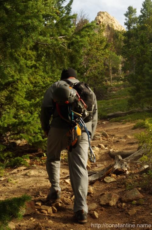
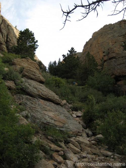
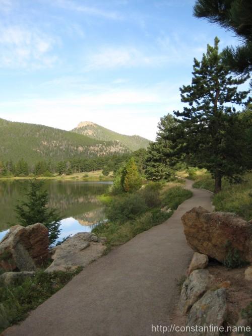
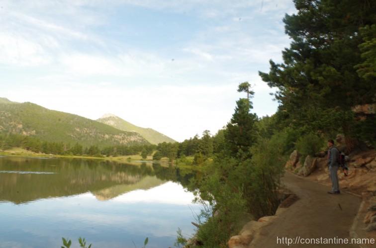
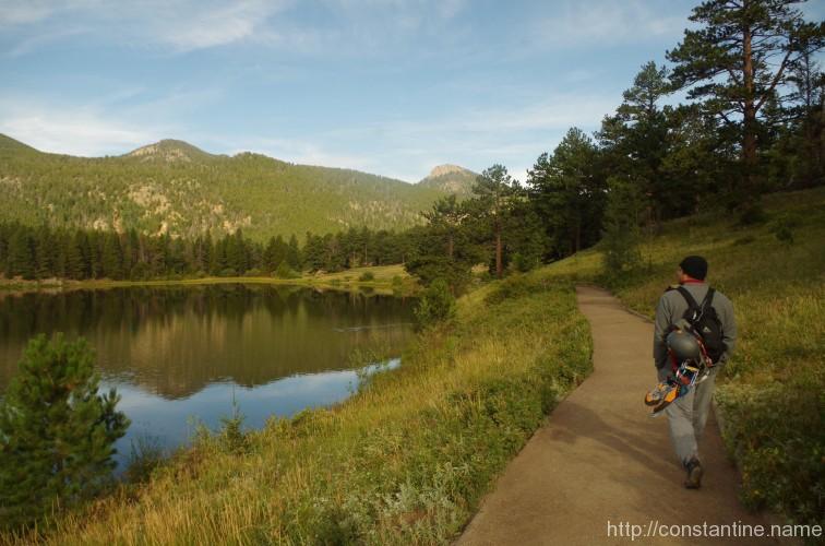
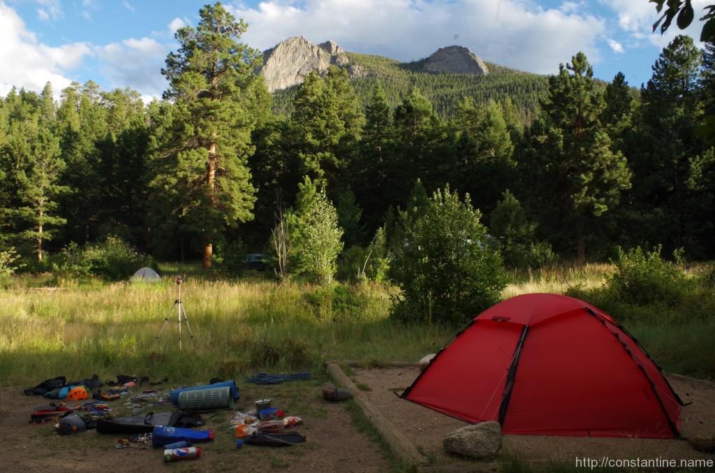
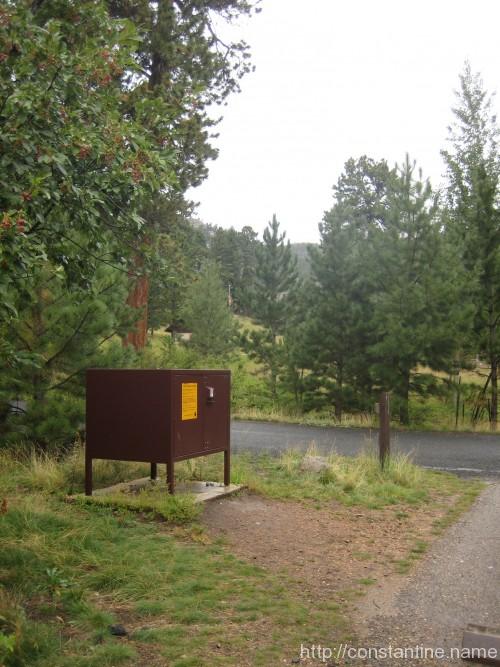
A short walk up from Lily Lake is a hidden ravene with sport climbing routes galore. (There are bolts drilled into the rock making it easy to clip in for protection.)
The first rock on the left is, well, “Left Hand Rock” and is home to Dark Days (5.8), which simply runs straight up a seamingly featureless curved slope. The next rock up is Dinosaur’s Foot, with the aptly named Index Toe (5.8) and Middle Toe (5.9—).
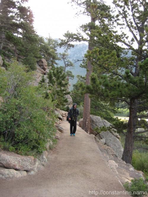
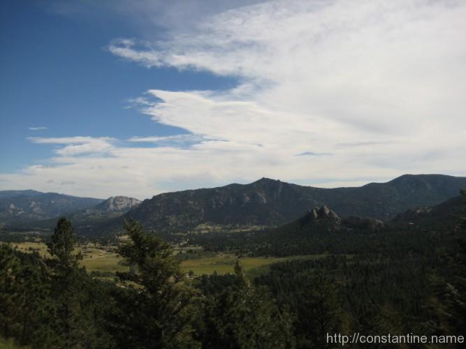
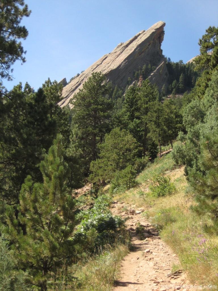
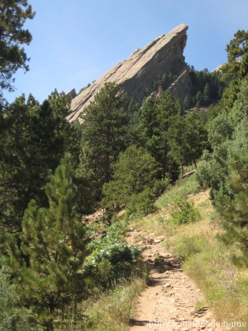
Sloggin’ up the approach at about 7,500′.
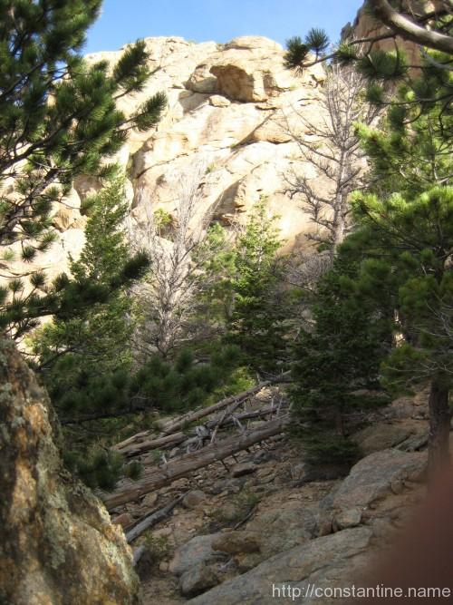
Our first glimpse of Left Hand Rock.
Looking up Dark Days (5.8)
Mike untieing after making Dark Days look easy.
A better view of Dark Days showing the slope.
Looking up the ravene at Index Toe on Dinosaur’s Foot.
Index Toe in the foreground, with Left Hand Rock behind/downhill.
Index Toe (5.8 *) straight up this keel.
Middle Toe (5.9— **) is a nearly vertical, blank wall.
Mike’s view from Middle Toe.
From the bottom of Middle Toe, looking at an easier line to the right.
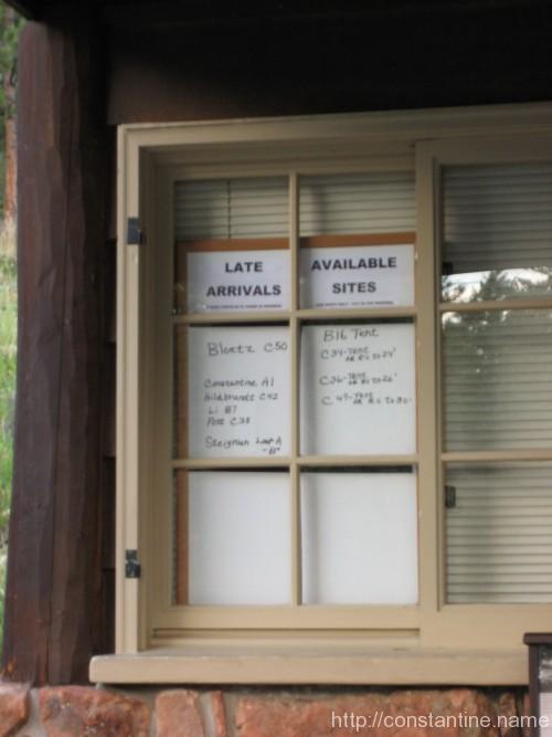
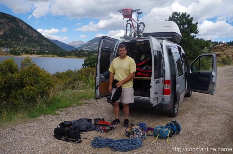
The local gear shop in Estes Park suggested a couple spots to do some top-roping nearby before heading into Rocky Mountain National Park.
We spent several hours climbing 20 foot routes up this “little” rock next to Mary’s Lake. I think I did 7 or 8 routes practicing footwork and technique with Mike either lecturing on details, or scrambling up to show me examples.
…unfortunately, neither of us took pictures of the climbing. Good practice, but not very photogenic.
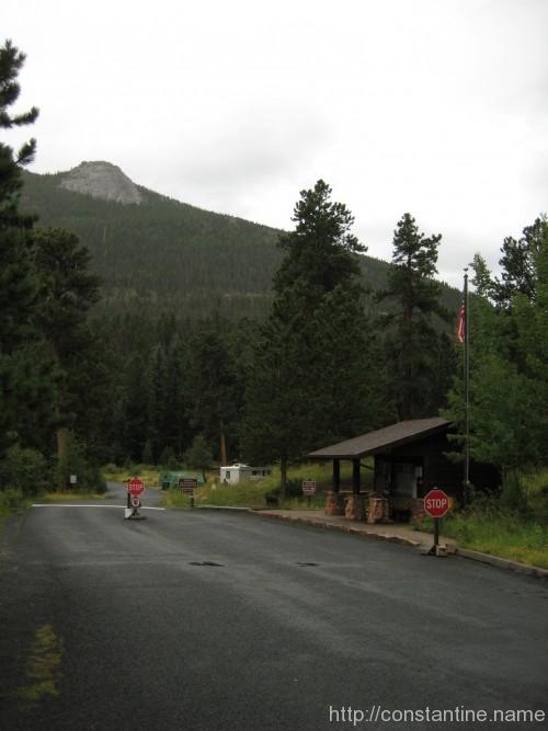
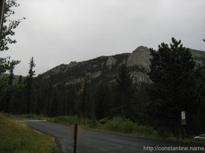
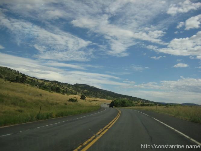
On Monday (25th) we left Boulder and drove to Estes Park, just outside of the Rocky Mountain National Park.
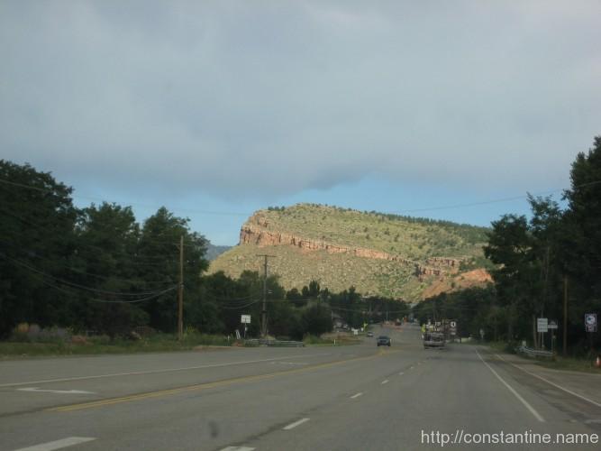
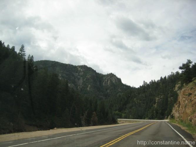
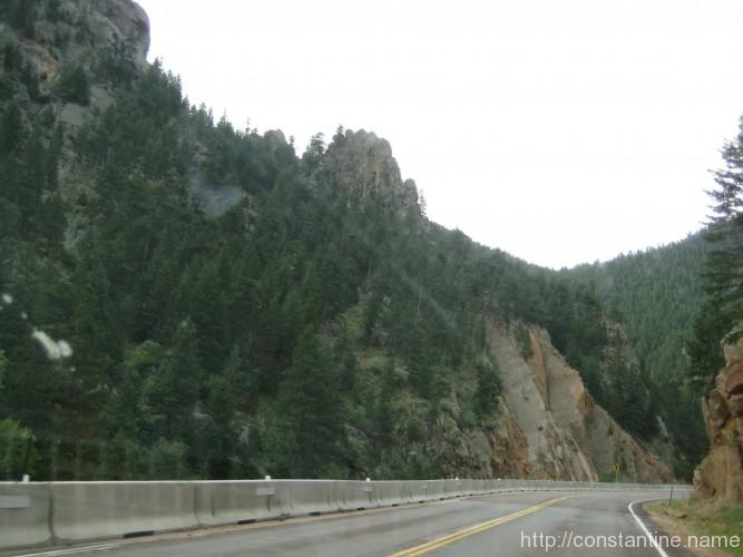
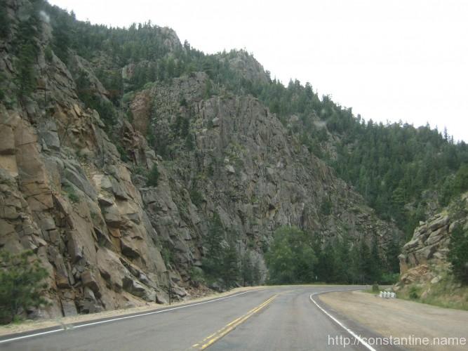
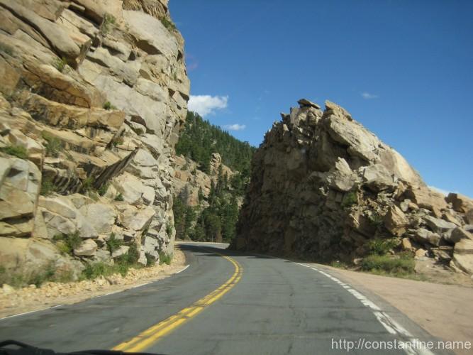
It’s a smooth cruise north along 36 out of Boulder. Construction on 36 near Lyons had us detour onto route 7. And what a spectacular detour! Route 7 winds up a narrow canyon, and then down into Estes Park.
In Estes Park, we found the local gear store, picked up a guide book for Lumpy Ridge and directions to some nearby sport climbing.
Almost like an open prairie north of boulder.
Road trip to Lumpy Ridge!
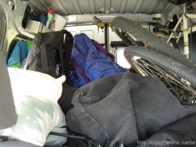
The back of the van. “Here be climbers!”
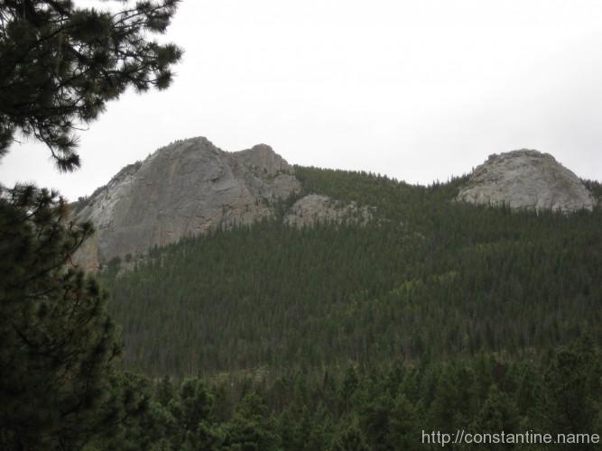
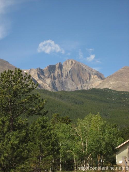
On top of route 7 we got a spectacular view of Long’s peak, and the famouse “diamond”.
Coming down into Estes on route 7.
Estes Park is nestled in a valley surrounded by mountains and granite. A climber’s paradise!
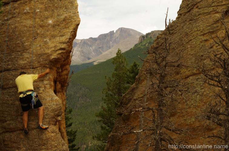
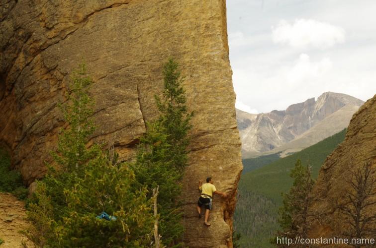
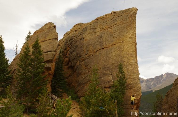
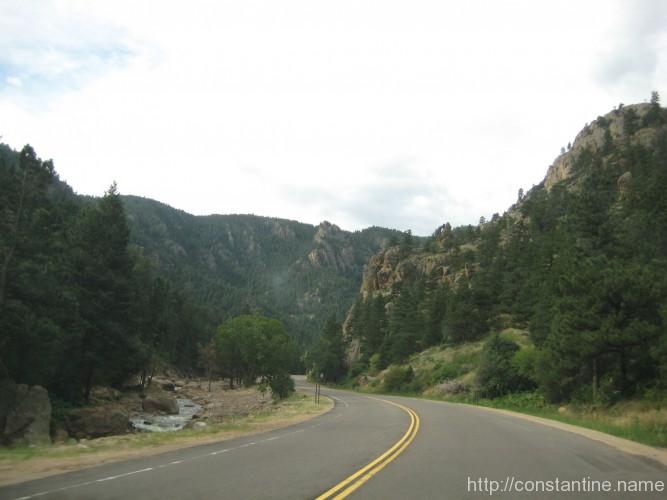
In prep for going to Lumpy Ridge this week, we decided to go back into Boulder Canyon; climb on some granite, and work on some finger-jam cracks to push my grade. (Lumpy is notoriously stiff.)
Cob Rock was the obvious choice being so assessible.
This is another roadside park, Tyrolean over Boulder Creek, and up a short scramble. We started up a 5.6+ which was a real struggle for me; but I did it. Then we moved onto the main 5.7+ route up the center of the north face. Parts were straightforward, but one off-width crack, and a second jam crack really gave me trouble. Took my first real fall off the wall at one point, and even had to jug up the line to get around one section. (Involves tying special knots with slings and standing up on the sling to move up the rope. Total cheat, but when your completely stuck on a face, up is up!) Fortunately we had just been practicing this the previous day.
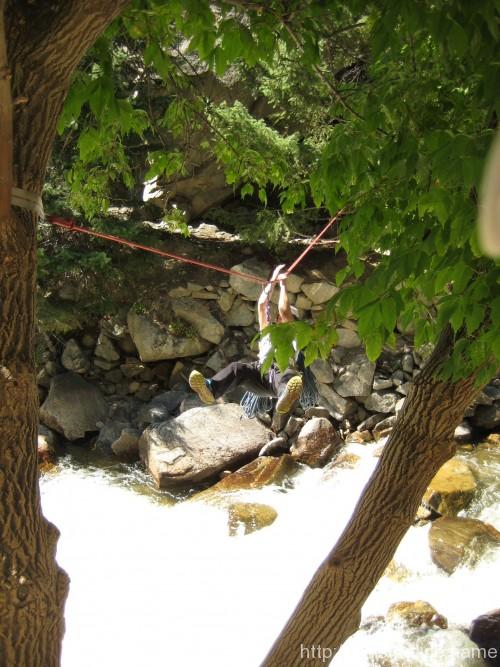
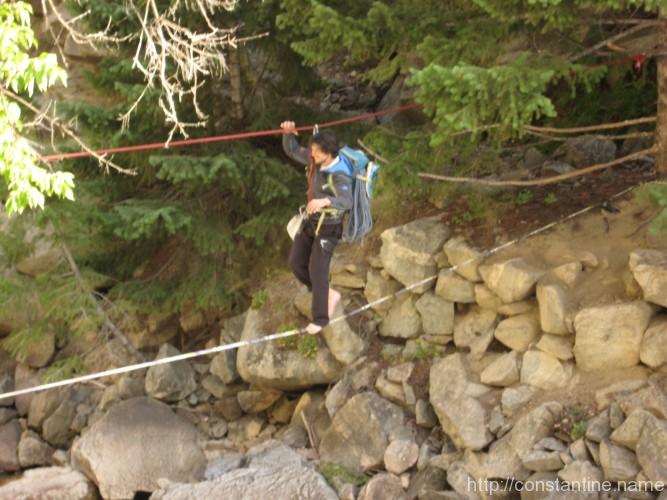
When we left, we discovered some local kids had rigged a slack line under the Tyrolean making for some unexpected fun on the exit!
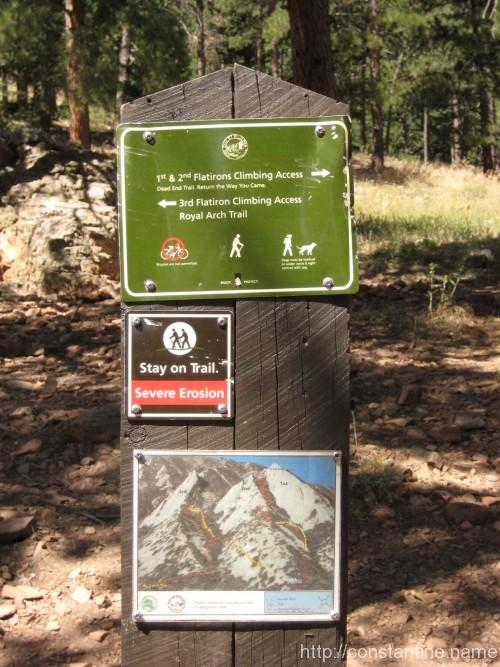
(That’s what the guide books say.) After our climbing in Eldorado and Boulder canyons, we decided to go back and run up the third Flatiron.
We started from the now familiar Chatauqua parking lot, and tore up the approach. Mike’s favorite dig is, “hiking?! …you mean walking. That’s what we do to get to the climbing.”
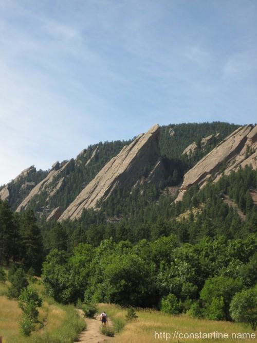
We walked up about 500 vertical feet to the third Flatiron. Gorgeous trees, rubble fields, scree… and all the while this huge prominence of rock is sticking up into the sky. The face is about a 60 degree incline, with just little undulations, texture and some little ridges for hands and feet. From the top, it’s a triple rappel off the back side, then a “walk off” — which means you scramble doen the steepest, gnarliest terrain you could imgine ever “hiking” down.
Our climb on the first Flat was more epic; mostly because it was my first climb and it took seven pitches, mostly in the dark. The third was a fun, three pitch cruise. The left edge, bottom to top, is about 1,800 feet (if memory serves). On our ascent, we started about halfway up, on the right side. By the second pitch, you’re looking down on Boulder, and the raptors are cruising *below* you sailing the ridge lift.
The Flatirons of Boulder Colorado
Mike lost in thought. (Probably was a girl off to the right.)
Walkers (climber wanna-bes) beware!
Up up up ever upward.
Some people simply scramble all the way up without safety gear! This is not mike nor me.
Slip slabbin away…. easy climbing, but the slope is endless.
View looking back down the slab from the first belay.
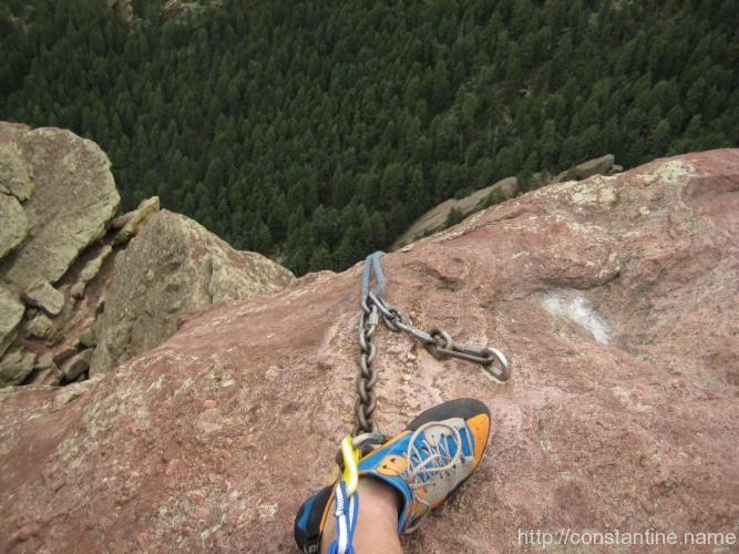
Huge cleft in the top of the flatiron.
Mike’s belay perch when I reached the summit.
Edge of the world at the top of the first rappel.
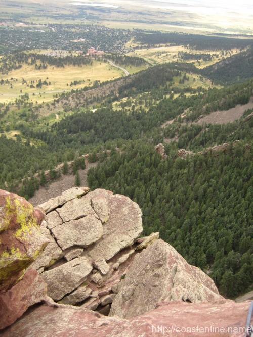
A view from the top looking south.
Down this is considered a “walk off.” Class three approach terrain.
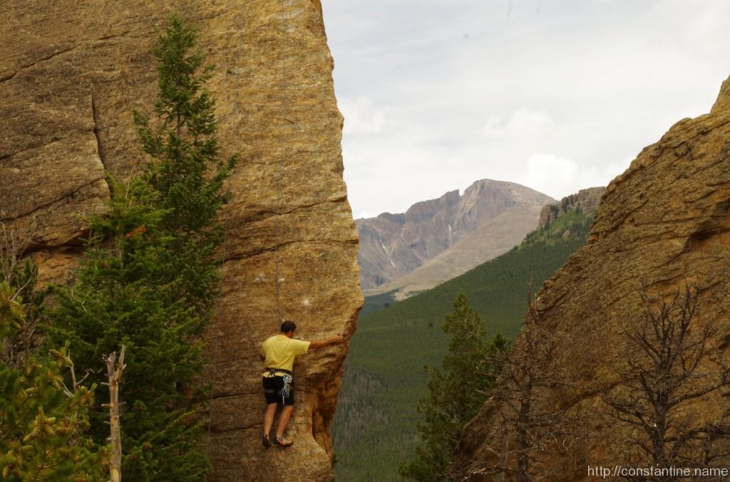


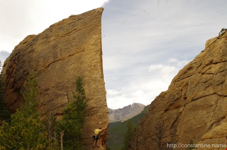
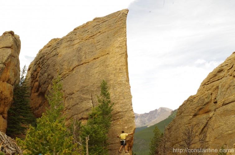
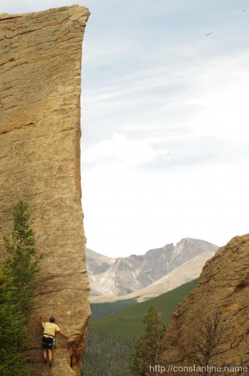

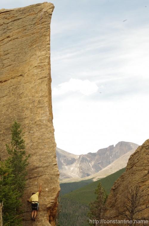

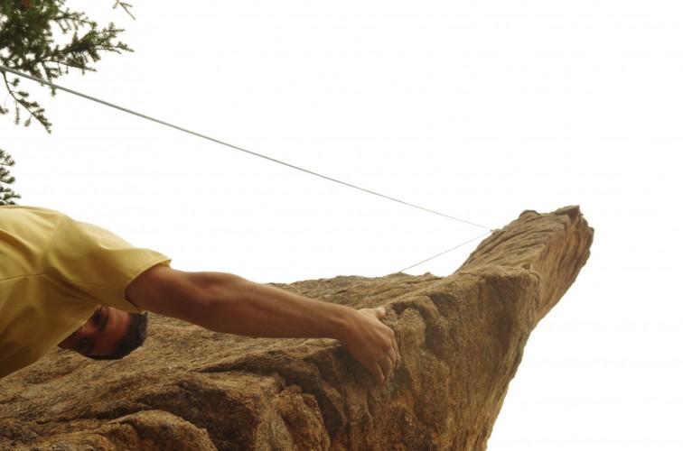
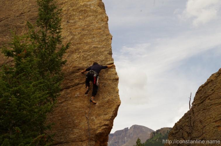

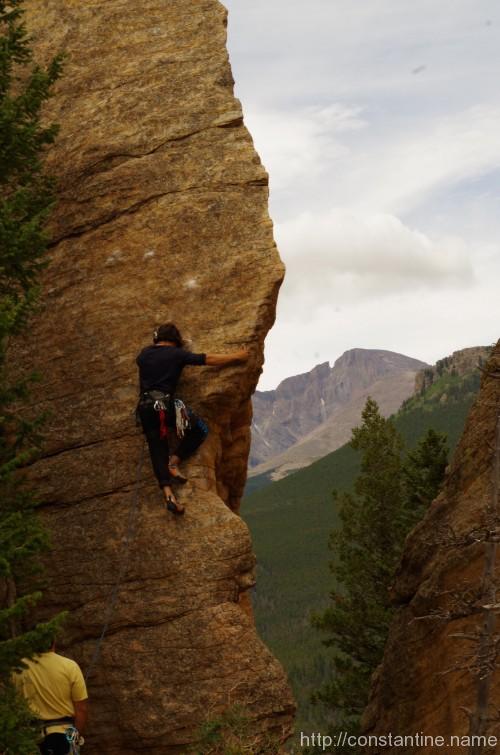
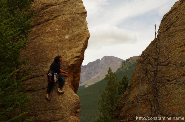
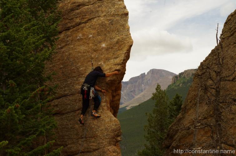
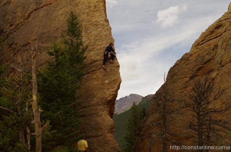
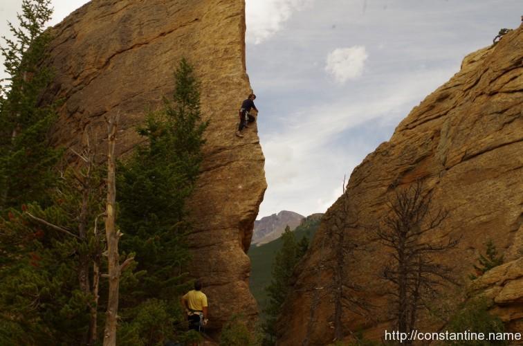


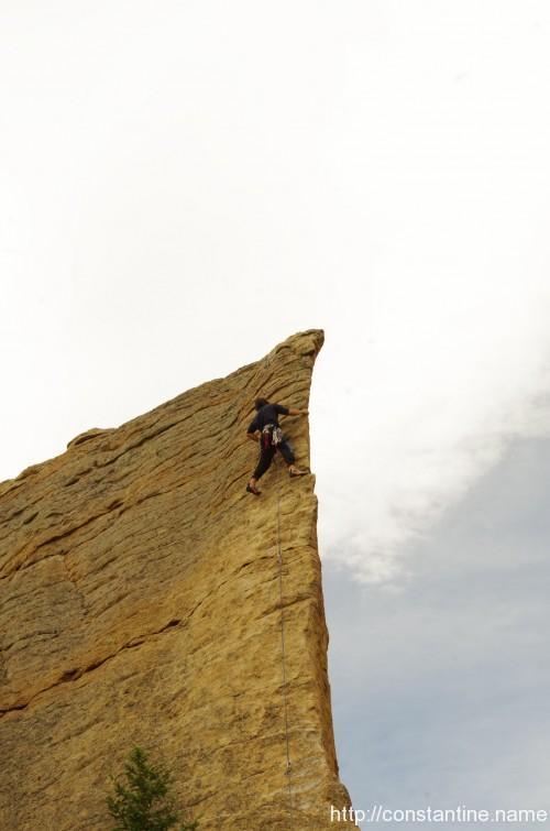
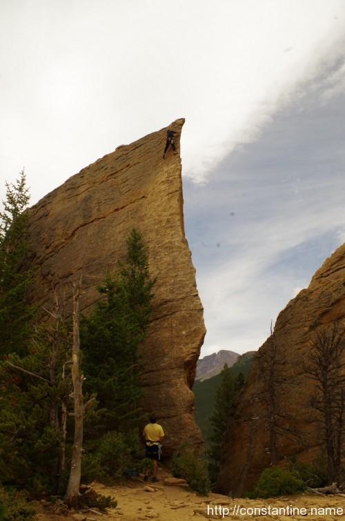
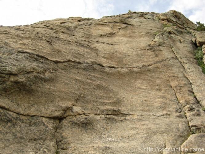


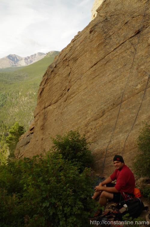
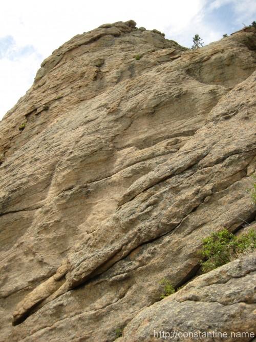
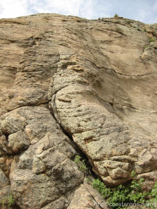


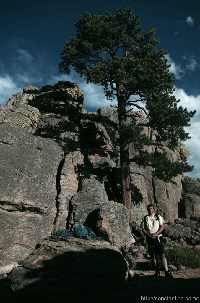

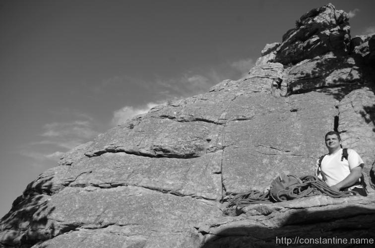


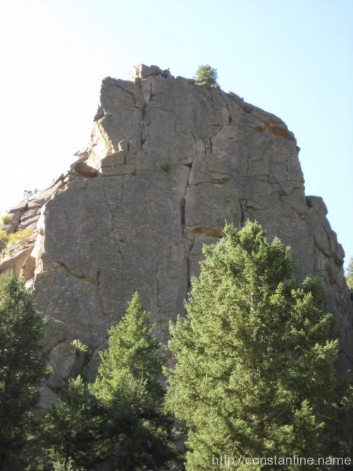
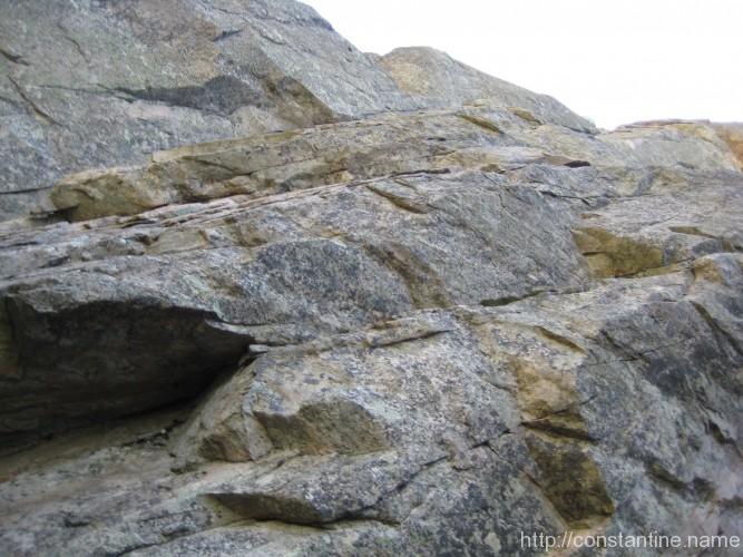


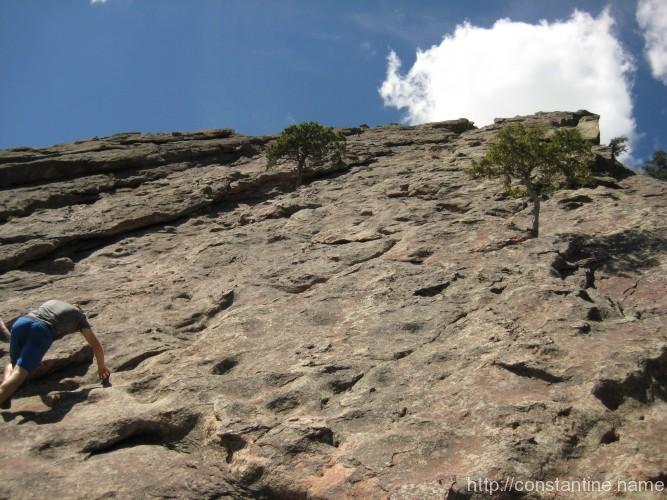


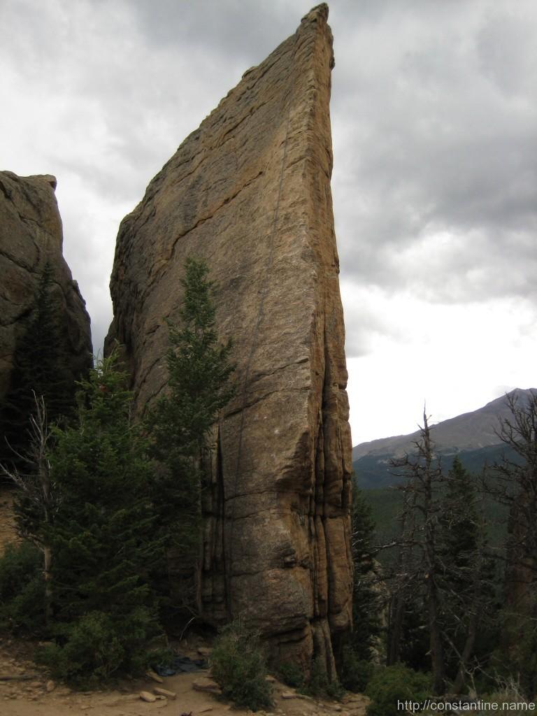
 This route is from the cover of the guide book. Mike pulled this clean, but I had to start way left after failing the crux down low at the start.